Thursday, February 28, 2013

Of knees and art

The results from my x-rays came back today, and the news was good:

Three views of the left knee reveal no fracture, subluxation, dislocation or other significant bone, joint or soft tissue abnormality. Small osteophyte anterior superior patella at the attachment site of the quadriceps tendon. No acute injury.

I'm not sure what all of that means, except that I got off relatively lightly from what could've been a nasty accident on Old Rag Mountain. Still, seeing as I like to go hiking often, the doctor referred me to an orthopedist to have my knee examined in greater detail. I have an appointment to go in early next week, Mandarin be damned.

Speaking of things Sino, I had a free afternoon today, and so went off in search of some inspiration in the form of "The Arts of China" permanent exhibition at the Arthur M. Sackler Gallery, part of the National Museum of Asian Art. Alas, I came away feeling a little disappointed. Not with the artifacts themselves, mind you, which were quite impressive. It was just that the collection was smaller than I thought it would be, and it didn't take long to see what was on display. Here are a few examples:


Tomb Guardian; China, Tang Dynasty  唐朝, 8th century; earthenware with three-color lead glaze


Daoist stela; China, Northern Zhou Dynasty 北周朝, inscribed and dated 572; limestone


Ritual wine vessel; 方壺 Fang hu; Eastern Zhou Dynasty 东周, 8th century B.C. (this date seems suspiciously old, even by exaggerated Chinese standards); bronze

A disclaimer: Generally speaking, I'm not a big fan of Chinese art. Like traditional Chinese furniture, I find much of it be oppressive and clinical in form and presentation, technically proficient (extremely so!) but lacking a certain warmth. The great exception is landscape painting, the kind done in ink on hanging scrolls, but there were only a couple of examples on display this afternoon at the museum, and both of them dated from the 20th century. So I came away from the Sackler Gallery feeling a little underwhelmed, especially in comparison to the small but interesting collection of Japanese art to be found in the adjacent Freer Gallery. I suppose if one really wants to be wowed by China's many centuries' worth of artistic achievements, the place to go is the National Palace Museum (Gù​gōng​ Bó​wù​yuàn) 故宮博物院  in Taipei (Tái​běi) 台北, though I hear the place is overrun these days by the tour group hordes coming over from the Chinese mainland.

One place that did live up to expectations at the Sackler Gallery was the gift shop. I walked away with a book on ukiyoe 浮世絵 woodblock prints, The Rough Guide to the music of Japan CD and, for my daughter, a children's book called Celebrating Chinese Festivals, the latter because my wife doesn't seem all that interested in keeping Amber in touch with the other side of her bicultural identity. I can only hope my bad knee can bear the extra burden :-)


Monday, February 25, 2013

Getting elbowed and kneed by Old Rag

Call me Lucky. For that's what I was today, extremely fortunate. It all came as I was attempting to climb Old Rag Mountain, the first real mountain for me to tackle since I've been in Northern Virginia. However, a nasty slip on a boulder, followed by a slide into a crevice forced me to abort the ascent...well, like an idiot, I tried to go on, but it proved to more than my banged up body could handle, so I had to turn around and make a long, uncomfortable descent back to the car. As I write this in the comfort of our living room, after finally making it back home, I'm still pondering whether or not to visit an emergency center to have myself looked at. While I'm waiting for my elbow and knee to make up their minds, let me present you with what happened...

Old Rag is Shenandoah's most popular and most dangerous hike. The number of blogs and websites about this hike attests to its popularity. The number of search and rescue missions each year attests to its danger. 


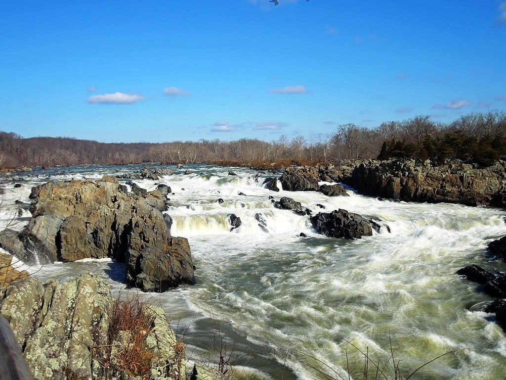
It was a beautiful drive through rural Virginia to reach the parking lot for Old Rag Mountain. The first leg was a gentle walk up to the trailhead, with the Hughes River to the right of the path.


A couple of hikers check out the signboard at the start of the trail. The beautiful weather today brought out lots of people. Considering what happened to me later, for once I was glad I wasn't alone on the trails.


The first 0.7 miles (1.1 kilometers) were an easy uphill walk through a forest of hemlock trees.


Soon, large boulders like the ones above started to appear, and the trail became rockier. Shades of things to come.


The views going up were incredible. I was really looking forward to checking out the vista from the summit.


The view from around 2800 feet (853 meters) high. From this point forward the mad scramble over the boulders commenced.


A typical example of what was ahead. Note the ice patch and the low-hanging rock. I had to get through this part by crawling on all fours.


And here is where it happened. As I was making my way across the face of the boulder on the lower right, I lost my footing and started to slip. My feet became wedged between the boulder I was on, and the one with the blue arrow painted on it. Unfortunately, while my feet stopped moving, my body continued to slide, and it started to contort itself. As I was doing my unintended 180, I could feel my left kneecap try to pop out of place, not once, but twice. Fortunately, I was wearing a knee brace, which kept everything in place. But I had to twist my body around on to my stomach in order to properly align the knee in its socket, and after doing so, I slid on the bottom of the crevice, landing on my back. As I looked up at the sky, I started to wonder if I was going to need an emergency evacuation.

What saved me was the knee brace. I have a very bad left knee, which has popped out of its socket on a couple of occasions (including once on a mountain in Taiwan, necessitating my having to push it back into place with my hands), and has threatened to do so many other times. Had it not been for the support I was wearing, my left kneecap would most certainly had migrated to a spot it wasn't meant to be in, and I would've had to either try and put it back again by myself (which is as gruesome as it sounds - trust me!), and/or just lie there and wait for help. I was fortunate (again) in that other hikers soon appeared on the scene, and they waited around to see if I was OK. Had an evacuation been necessary, getting the word down to the rangers probably wouldn't have been a problem. I will never complain about crowds again (at least not here in the States).

After catching my breath, I got up and tested the knee. Everything seemed to be in order, so I thanked everyone for stopping to help and reassured them that I was fine. Now I'm not an experienced mountaineer, but I have done quite a bit of hiking, so I'm pretty confident that what happened to me could've happened to almost anybody. In fact, I was quite pleased with myself that I kept calm throughout and, in a cool-headed way, was able to extricate myself from my predicament without damaging the knee. However, I am an idiot. Not for slipping and falling, but for not turning back right there and then.

Yes, that's right, I decided to keep going uphill and over more boulders, despite the close call. And it turned out it wasn't just my knee I had to worry about - my left elbow was starting to feel funny. But for some stubbornly dumb reason, I wasn't going to be cheated out of the view from the summit of Old Rag, and I thought that if I could just get over the rocky obstacles and make it to the top, it would be an easy walk downhill from the other side.

What I hadn't counted on was the need for upper-body strength. My legs have always been strong, but at the same time, I've always been a weakling above the waist. As I struggled to get over the boulders, my elbow started to bother me more and more, to the point where it was threatening to act like my bad knee every time I tried to put weight on it. But still I pressed on.


There were more stunning views on the way up, but it was getting harder and harder to appreciate them.


After scrambling over some boulders, I was presented with this view. At this point, I seriously thought about throwing in the towel, but the idea of trying to make my way back down wasn't very appealing, either.


Another spot where I had to crawl on all fours, which was becoming a little more than agonizing on the left side of my body. At least on the way back, I could make my way on my butt.

Finally, I reached the Outcropping Too Far. I tried to hoist myself up, but my injured elbow wasn't having any of it. So I finally accepted reality, and turned around for the long, uncomfortable descent. A couple of times I had to ask people to give me a hand getting up and over some of the obstacles, as I was afraid that putting any more weight on my left elbow was going to result in it popping out of place (or worse). In the end, I did make it back to the car without further incident, but I developed some serious leg cramps on the long drive back to Falls Church.

Lessons learned? Plenty, I hope. Always, but always wear a knee brace. Don't press on if you're obviously in some discomfort (unless you've come too far to turn back). And start doing something about building up some upper-body strength. I suppose I'd been lulled into a false sense of complacency on similar terrain in Japan and Taiwan, where chains and ropes are often provided to give 97-pound weaklings like myself a chance to get over the obstacles in our path to the top. Here at Old Rag Mountain, it appeared to be survival of the fittest.

Someday, when we're back in Virginia, and the weather is warmer and my body is stronger, I'm going to tackle Old Rag Mountain again. Hopefully, I'll be wiser. In the meantime, I'm going to take it easy tonight and see how my aching elbow and knee feel. I have a feeling I should seek a physician tomorrow at the very latest.

At least I have a good excuse not to do my Chinese homework!


Tuesday, February 19, 2013

Happy 281st, George


It's Presidents' Day today, when Abraham Lincoln's birthday on February 12, and that of George Washington on the 22nd of the same month, are combined to provide retail outlets with another opportunity to advertise sales. Back at the dawn of time, I have vague memories of the two birthdays being celebrated individually, but that hasn't been the case for eons (if it ever, in fact, was). Other than being a federal holiday, I don't recall there being any special celebrations on this occasion, by my wife heard that there was going to be an official George Washington Birthday Parade in Alexandria on the 18th (today). Seeing as Pamela was eager to visit Alexandria's Old Town area, where the parade was going to be held, our holiday plans were quickly made. It turned out to be a good choice. Though it was cold again today, the skies were clear and we scored a spot up front, next to the reviewing stand. Suffice it to say, a good time was had by all (three of us).


Old Town Alexandria is only a short drive down Leesburg Pike from our temporary home in Falls Church, but, fearing traffic jams, we traveled by Metro to the King Street station, and walked down King Street to Old Town and the parade route. But not before fortifying ourselves with some hearty brunch fare like steak and eggs (above) while en route.

Then it was time for the parade, and another introduction to a piece of Americana for my wife and daughter. For about 90 minutes we watched military units, police and firefighters, boy and girl scout troops, Legionnaires, car clubs, school marching bands, local politicians, fraternal orders and the like pass by the reviewing stand to the sometimes corny, but always enthusiastic, commentary from the parade announcer. Amber sat right at curbside, and had a great view of the proceedings, which apparently have been going on since 1923.


There were several groups in Revolutionary-era garb. The unit above stopped to fire their cannon and muskets for several extremely loud volleys, temporarily giving Taiwan and its firecracker tossers a brief run for their money in the noise-generating department.


No American small-town parade would be complete without the Shriners in their silly hats and even sillier cars. The latter were my daughter's favorite part of the parade, and considering the work the Shriners do for sick children, I say they let them have their fun.


Once the parade was over, we spent what was left of the afternoon wandering around Old Town. Alexandria's visitor center is housed in Ramsay House, the oldest in the town (1724). That's my wife and daughter on the porch, poring over maps and deciding where to go next.


"Next" turned out to be Carlyle House, built around 1753. The free admission today (it usually charges $5 to tour the interior) meant it was busy inside.


On the waterfront, with the sun in our eyes and the Potomac River behind us. The highlight in this part of town is the Torpedo Factory Arts Center, once a torpedo factory and now a three-story collection of art galleries, most of them featuring the work of white, middle-aged women.


Amber didn't let the cold or the walking get her down. Here she stands in front of Alexandria's post-Civil War City Hall.


Still 元気 on the bus ride back to Falls Church. Because of the parade, we were only able to scratch the surface of the many things to see (historical buildings, restaurants, shops etc.) in Alexandria's Old Town. We probably won't have time to go back before we're scheduled to ship out in mid-April, but I'm sure it'll still be around the next time we're back in town.

Then again, considering the struggles I'm having with Mandarin, we might have plenty of time to visit Old Town again real soon.


Monday, February 18, 2013

No snowjobs

Snow has been called for in the forecast this Presidents Day holiday weekend, but the unpredictable science has proved to be, well, unpredictable, much to my daughter's disappointment. Though it did snow for a while yesterday (Saturday) afternoon, long enough to coat the ground, it didn't do it in quantities sufficient enough to go sledding, and it's looking increasingly likely that Amber is going to have to wait a long while before she'll have a chance to try out her new saucer-shaped plastic sled. Today, unfortunately, was clear for the most part, with only the odd flake or two floating about in the air. But while the snow largely failed to materialize, the cold did stop by, not only to say hello, but to stick around like an unwanted house guest. The temperature hovered around the freezing point all day Sunday, quickly dipping to 26°F (-3°C) as we made our home this evening from a day of outdoor walking. For while it was chilly to the point of freezing today, it was no excuse to stay indoors, and the three of us spent most of the afternoon walking through the woods of Greenbelt, Maryland.


Of all the walks I've done so far in the Washington, D.C. metropolitan area, Greenbelt Park is probably one of the least interesting. Not bad at all, but hardly inspiring. It was a 5.3 mile (8.5 kilometers) traverse around the park's boundaries on the mostly-level Perimeter Trail. While the woods were quiet, we were never far removed from signs of civilization (highways, apartment buildings etc.), and there was a disturbing number of fallen and cut trees lining the entire route (see above). Still, it was good to get outside, and the air was definitely crisp.


Amber bundled up against the chill. The cold didn't stop her from expending vast amounts of energy, unlike her mother, who was in full-Taiwanese dress overkill and wouldn't let me take her picture.


Other than birds and the occasional squirrel, wildlife was pretty scarce this afternoon. They were probably in their hutches, sipping hot cocoa by a warm fire.

Starkly-beautiful scenes such as these are an uncommon sight in Taiwan, where evergreens rule the roost.


Amber didn't let the lack of snow bother her. Being outside is definitely preferable to staying indoors, watching Nick Jr. or playing XBox.


Still Creek lived up to its name. Behind us, the traffic on Interstate 495 was roaring by just 25 yards (22.9 meters) away.


Some trees apparently had met with very violent ends. This one had been peeled and snapped off by some obviously powerful force of nature.


Dude, shrooms


Amber and I stopped to check out this toppled tree. The depression it has left behind has been filled up with water. To see how deep it was, we used a stick to measure the depth of the water. If my daughter were to have stepped into the depression, the water would've gone up to a point halfway between her chest and her waist.


Following the end of our roughly 2½-hour walk, everyone was hungry, particularly Pamela. So we drove over to Rockville, to an area known as "Little Taipei", where we had dinner at Bob's Noodle 66, the closest thing to an authentic Taiwanese restaurant in this area. At least it was authentic enough that the sausages came with cloves of garlic, just as they do when you buy them from street vendors back on Taiwan.


A visit to the Asian supermarket next door to the restaurant resulted in the purchase, at Amber's insistence, of some Dòuhuā 豆花, a kind of bean curd that my daughter used to enjoy eating for dessert back in the days when we lived in Fēng​yuán 豐原. You can take the girl out of Taiwan, but you can't take Taiwan out of the girl.


Sunday, February 10, 2013

A good case of the bends

I've been on some pretty nice walks in the Washington, D.C. area, especially here in Virginia, but today's hike was the nicest by far. Walking a round-trip total of 6.8 miles (10.9 kilometers) in 4¾ hours, I started out from Riverbend Park in Fairfax County, made my way along the Potomac River down to the Great Falls and beyond, before turning inland and then making my back along the same route. The skies were clear and the weather chilly (high 30's F) but not uncomfortable. The fact I was facing the sun much of the time on the trails provides a convenient excuse for why my photos are nowhere close to being as stunning as the actual scenery, but I'll remember this outing for a long time to come.


The waters of the Potomac were deceptively tranquil as I set out along the Potomac Heritage National Scenic Trail.


This massive rock outcropping was apparently once sitting at the bottom of the ocean - it's 500 million years old, formed when the African continent slammed into the North American continent, lifting the seabed in the process. Or you can believe in edenic gardens. The choice is yours.


This small aqueduct dam marks the obvious southern limit for boaters on the Potomac. From this point, only a moron or someone with suicidal tendencies would want to go into the river.


This seemingly languid stretch of river is actually the remnants of a canal that was designed to skirt the Great Falls. Railroads and high maintenance costs combined to put the canals out of business.


The current was starting to get swifter as I approached the visitor center at Great Falls National Park.


Inside the visitor center could be seen displays such as the above rock, covered in petroglyphs, and exhibits on a time when, thanks to a trolley that ran from Georgetown in Washington during the early years of the 20th century, a visit to the Great Falls was a popular day trip. Outside the visitor center are three overlooks providing scenic vistas of the falls.


Overlook 1


Overlook 2


Overlook 3


Yours truly poses with a post showing various high-water marks from Potomac flooding. The highest was in 1936, which you can just make out at the top of the photo. 


I continued past the Great Falls as I followed the Potomac. The bridge pictured above connects Olmsted Island with the Maryland side of the river. Amber, Pamela and I visited here back in September, when we took a boat ride along the C&O Canal and took a look at the waterfalls.


Mather Gorge, named after the first director of the National Park Service


For the most part, all that can be seen of the Patowmack Canal are the cut in the landscape and the remains of the locks.


Looking down to the point where boats went back into the Potomac from the canal


There were moments when I could forget that the year is 2013, and that I'm living in a country of 315 million people.


River Trail came down from the rocky ledges above to briefly make contact with the Potomac at river-level at Sandy Landing.


The trail soon started rising again, and eventually made its way inland, but not before providing final glimpses of the Potomac.


Here being Virginia, there were plenty of ruins to be seen in the woods. What the sign doesn't inform us of is that Matildaville was founded by "Lighthorse" Henry Lee, Revolutionary War officer, governor of Virginia and father of a traitor to the Union.


Eventually, the trail made its way back to the visitor center and beyond, as I followed the River Trail back to where I started. On the way back I passed by more remnants of the Great Falls Skirting Canal.


The local waterfowl are no doubt impervious to the winter chill


Passing by the aqueduct boundary again. In the background is Conn Island.


For the last leg of the return journey, I detoured into the woods for a quiet walk among the trees before finding my way back to the car. This afternoon's hike was one of the finest I've been on, and the river scenery brought back memories of driving along the Columbia River separating Oregon and Washington. Only this time I was on foot, a much preferable mode of travel.