Showing posts with label civil war. Show all posts

Monday, April 22, 2019

Muddying the Waters


Springtime in the cemetery

The best-laid plans of mice and language learners. As none of you no doubt recall, last Christmas Eve I drove out to do some hiking at Bull Run Regional Park in Centreville, Virginia only to discover that the boardwalk there was in a state of disrepair, making it unable for me to start out on the trail due to the muddy, wet conditions. Fast forward to Easter eve, and my return to the park to try again. With spring in full bloom, and the park noted for its flowers, I figured correctly that the boardwalk would have been repaired by now. What I hadn't taken into account was the effect that Friday evening's heavy rainfall in the DMV region would have on the condition of the trail. Read on...:


Posing with my copy of AMC's Best Day Hikes Near Washington, D.C. Seven years after purchasing it, I've completed (or at least attempted - see here for one notorious failure) all but three of the fifty hikes described in the book:


The waters along the path were teeming with tadpoles:


The park is famous locally for its bluebells, and a lot of visitors came out on Saturday to see the flowers despite the muddy conditions:


The mud got progressively...er, muddier as I made my way along the path, but I trudged on, determined to do the hike. However, 35 minutes into what I had planned to be a two-hour walk (at the two-hour mark I was going to turn around and retrace my steps back to the start) I came across a section of the trail that was completely inundated. Without proper footwear (i.e. waders), I had no choice but to turn back. At least I probably wasn't the only one who would have had to yesterday:


On the way back I was startled by a very loud sound coming from the forest behind me. I turned around to see a tree falling over. Now I know for a fact that a tree falling in the woods does indeed make a sound - in this case, much like a gunshot (there is at least one shooting range in the area).

With my hiking plans on hold but not wanting to waste a beautiful April day, I decided to take a drive through Virginia's beautiful horse country. On the way out of the park I passed by a Vietnamese Buddhist temple:


I  soon found myself in the Manassas Battlefield National Battlefield Park, so I pulled off the road, parked the car and got out to have another look at the Stone Bridge (which I'd seen previously back in the summer of 2013 during a noisy cicada outbreak), where the first shots of the First Battle of Manassas were fired on July 21, 1861. The bridge itself was blown up by the Confederates; what stands today was completed in 1884:


The Bull Run, from which the battles took their names:


I was able to get some walking in, thanks to the 1.4 mile (2.3 kilometers)-long Stone Bridge loop trail:


Having hiked the main battlefield six years ago, I skipped the other sites in the area and continued my drive through the countryside on the hella scenic John Mosby Highway. Driving solo while using my phone's GPS for navigation meant I couldn't stop to take photos as I passed through charming villages such as Aldie and Middleburg, though I did manage this shot in the latter while waiting at a stoplight:


Somewhere near Marshall I had to wait not once, but twice (at separate railroad crossings), for the same freight train to pass by:


On the way back home, I made a quick stop at the Stone House, another First Battle of Manassas site that I'd visited six years ago:


Reading my blog post from back then, I see that I mentioned how two wounded Union soldiers had carved their names into the floorboards, and of how I inexplicably neglected to take photos of them. This time I partially corrected that oversight:


I climbed the short hill behind the Stone House, and looked over the battlefields to the north...:


...and the south:


Back in the present day - last Thursday afternoon I introduced my daughter to Ethiopian cuisine, taking her out for lunch at the EYO Restaurant and Sports Bar in nearby Bailey's Crossroads (I tried to get my wife to join us, but she said she would rather wait until we get to Addis Ababa. Shu-E claims the food would be more "authentic", but I suspect she doesn't want to have to eat a meal with her hands until she has no other choice). We ordered the vegetarian platter and the lega tibs. Amber said afterward she was satisfied with the meal, though it was something she couldn't eat "all the time":


The area where the restaurant is located is called Skyline, and is home to a number of Ethiopian businesses:


As our family isn't religious (and our daughter is too old to be hunting for dyed eggs, though she did get a chocolate bunny), this Easter was no different than most recent Sundays. While Amber and Shu-E were out in the afternoon (for Chinese class and grocery shopping, respectively), I took a walk through the local cemetery. What a beautiful place to be resurrected, except if the bodies here returned to life, it would probably be as part of a zombie apocalypse and not the Rapture:


Of course, I can never get away from Amharic (none of you will remember that a month ago I took a photo of this same headstone before it was put over the grave):


For Easter dinner, the three of us went to this trendy Asian food court in Annandale, popular with hipsters and young families. Neither I nor my wife were too impressed with the fare and the atmosphere, though Amber liked her tonkatsu:


Being an Orthodox church, Easter in Ethiopia falls on the following Sunday. Our teacher has promised to take us to an Ethiopian Orthodox house of worship on the Orthodox Good Friday this upcoming week, so stay tuned...


Sunday, June 9, 2013

Ain't no bull

In last week's episode, the Kaminoge family visited the Antietam National Battlefield, site of the bloodiest single day in American military history. This afternoon, your humble scribe made a solo sojourn to the Manassas National Battlefield Park, supposedly less than half-an-hour by car from Falls Church, except when traffic on Interstate 66 heading west is stop-and-go, which is was what is was like today around noon. Two major battles of the American Civil War were fought there, the First Battle of Bull Run (which was also the first major clash of the war) on July 21, 1861 and the Second Battle of Bull Run from August 28 to the 30, 1862. In both battles, the Union forces were soundly defeated.

Today's walk was longer than last week's, but the heat, while still warm, felt a lot less oppressive. Today, in fact, was supposed to have been rainy due to a tropical storm in the southern part of the U.S., but it actually turned out to be very sunny. I followed the First Manassas Trail on a 5.4 mile (8.7 kilometers) loop around the battlefield site. The length of the trail meant that I was alone for much of the time, and other than the cicadas (more on them, later) and the two times I had to cross US 29, it was a very peaceful trek. I would like definitely like to do more of these Civil War-related hikes/walks in the future.


A statue of the traitor defender of an immoral way of life hero of the Northern War of Aggression, Confederate General Thomas "Stonewall" Jackson. Jackson received his nickname during the First Battle of Bull Run, when the arrival of his brigade helped the Confederate forces turn the tide against their Union foes on Henry House Hill, where this statue stands. When the southern general Barnard Bee saw Jackson and his men arriving on the scene, he encouraged his troops by yelling "There is Jackson standing like a stone wall. Let us determine to die here, and we will conquer. Rally behind the Virginians!". The First Manassas Trail starts out by going through the same woods that Jackson's men used to reach the battlefield.


Just before entering the woods, the trail passes by some cannons. The grass in the background has been left to grow high in order to recreate the sea of weeds that existed during the time of the battles.


Much has been made in the local media recently about Brood II, the larger-than-usual cluster of cicadas that burrow out of the ground after a 17-year existence, and make the above-sounding racket as the males seek mates. This was the soundtrack that accompanied me as I made my 3½-hour walk along the trail, and I noticed the cicadas sound different from those that I had grown accustomed to during summers in Japan and Taiwan.


It isn't the best of photos, but it was the only shot I could get of a deer standing at the opposite end of a large clearing. It ran away before I could get any closer. A few minutes later, I was checking out a cicada husk on the ground. As I looked up, I noticed a deer looking at me just a few feet away, but it fled before I could react. Later on, I came across a third deer walking along the trail ahead of me. I tried to get a picture, but the best I could do was to get a shot of its rear end, and not a particularly good one at that (the photo, I mean, and not the deer, which had a fine ass).


Cicadas are admittedly hideous-looking, but they're perfectly harmless...except when they land on exposed parts of the body and dig their claws in. I served as a landing site for several of the horny buggers during the course of my walk. In addition to cicadas, there were numerous butterflies and dragonflies out and about this afternoon.


The scenery along the First Manassas Trail frequently alternated between shaded woods and open clearings.


Crossing over Youngs Branch, a tributary of Bull Run. The stream probably looks just as it did when soldiers made their way through the woods 152 years ago.


Two shots of Stone Bridge, the site of fierce fighting during the first battle, where it was destroyed by Confederate forces. Union troops crossed here on a temporary structure while retreating at the end of the second battle. The current bridge dates from 1884.


Bull Run, which lent its name to the two battles fought in the area. They're also known as the "First (and Second) Battle(s) of Manassas".


It was along this part of the trail that I caught site of the third deer. These woods were also the scene of fierce clashes between opposing forces, and it wasn't hard to picture soldiers making their way between the trees while preparing to engage the enemy.


This self-portrait was taken in front of the Carter Cemetery. Several generations of Carters lie in the walled-off enclosure behind me, but there weren't any gravestones or other kinds of markers to indicate who was who, and where they were. I took this picture hoping ghostly images would appear around me, but once again the rational world has to suck the life out of the party.


The George Stovall Marker marks the spot where a young soldier from Georgia was shot and killed. His last words were "I am going to heaven."


All along the trail could be seen the holes from the cicadas that emerged after spending 17 years living underground.


One of a number of markers along the route containing descriptions of the fighting by those who were there.


The First Manassas Trail emerges from the woods at Matthew's Hill, and the remainder of the path going back to the visitor center passes through the wide open fields where much of the fighting took place in the opening stages of the first battle. In the far distance, you can make out Henry House and the visitor center.


It was a long walk back through the fields. After all those years living in Japan and Taiwan, I'd forgotten just how wide and open spaces in the United States can be at times. It's what I love most about this country.


Three photos of the Stone House, an original farmhouse/inn that was used by the Union Army as a place to treat the wounded during the first battle. The house somehow managed to survive the battle intact, and has been restored to how it looked circa 1861. On the second floor could be seen the names of two wounded Union soldiers, which they carved into the floorboards while they were being treated. Eugene Geer later died due to complications from his wounds, but Charles Brehm ended up living to the ripe old age of 90. I don't know why I didn't get a picture of the carvings.


This building is a reconstruction of the Henry House. The original was badly shot up during the last stages of the battle. It was on Henry House Hill that the Union soldiers were pushed back by the Confederates, and began their disorganized, panicky retreat all the way back to Washington, D.C., along with the civilians who had come out to watch the fighting.


The grave of the house's matriarch, Judith Henry. The 85 year-old invalid was killed by a Union shell, which was meant for the Confederate snipers who were occupying her home. 


The last item of business before returning home to Falls Church was to check out the displays inside the visitor center. Soldiers on both sides of the First Battle of Bull Run were inexperienced and hopelessly naive, all believing that the war would be over quickly, with their side being the victorious one. What actually happened at the end of that day in July 1861 was that everyone realized that the war was going to be a long and difficult affair.


Sunday, June 2, 2013

Feeling buff

If you're an American Civil War buff, the area around Washington, D.C. is just for you. A number of major battles, most notably the two at Bull Run, are within an easy drive of our nation's capital, and even in our area, there are numerous historical markers that can be seen, explaining various skirmishes that occurred between Union and Confederate forces. Today, with the temperatures starting to climb and my knee rapidly on the mend, the three of us drove out into the beautiful countryside of central Maryland to visit the Antietam National Battlefield. The Battle of Antietam, fought on September 17, 1862, remains the single bloodiest day in the history of American warfare, with more than 22,000 Yankee and Rebel soldiers killed, wounded or missing. It was hard to believe that the peaceful and pleasant idyllic rural scenery we saw today on our nearly three-hour, 3.5 mile- (5.6 kilometers) walk was the site of so much carnage. 


Burnside Bridge, a pretty little bridge spanning Antietam Creek. It took Union forces three attempts and 500 casualties to wrest control of it from Confederate troops.


My daughter poses on the bridge. According to its Wikipedia entry, Burnside Bridge is one of the most-photographed bridges of the Civil War.


This tall Sycamore tree was probably just a sapling at the time of the battle. Northern soldiers attacked from this side of the bridge, where they were raked with fire from Southern guns and artillery on the opposite bank.


Another view, taken from the Union Advance Trail, a one-mile (1.6 kilometers) route that makes a loop from Union side of the bridge.


The Antietam National Battlefield area is dotted with numerous monuments. This one is dedicated to the 11th Connecticut Infantry, which suffered heavy casualties while participating in the attack on Burnside Bridge.


Seeing these folks enjoying the good life on the Antietam Creek made me wish that I'd brought along a pair of swimming trunks.


Amber and I alongside the banks of Antietam Creek. I'm easily drawn in by such idyllic scenes, which evoke images of what much of this country must've looked like in those days before the U.S. nearly tore itself apart during the Civil War.


The shaded path offered a welcome, cool respite from the day's heat. The temperature today was over 90°F (32°C).


The leaves of this plant left a reminder across the knuckles of my right hand that I should pay more attention to what I might brush up against while out on the trails. I'm still feeling the effects of the nettles this evening as I'm typing this.


Signs like this one were a constant presence, a reminder to walkers of the history of the ground upon which they trod.


Mother and daughter cross an exposed section of trail. My wife, being Taiwanese, appreciates a sunny afternoon in June about as much as a vampire would.


A corn field. Behind me was the spot where Union soldiers and artillery massed in preparation for their final attack on the Confederate positions. The Northern general McClellan failed to take advantage of his side's numerical superiority to deliver a knockout blow, and as a result, the Southern army was able to retreat to Virginia largely intact.


From the expression on my wife's face, it's obvious she relished the opportunity to go for a walk on a sunny day in an atmosphere soaked in historical significance.


The area behind me in this self-portrait was where the Confederates made their final attack, which was successful in saving the main rebel force from the Union assault.


An obelisk honoring the 16th Connecticut Infantry, and the 43 men of that unit who were killed in the battle.


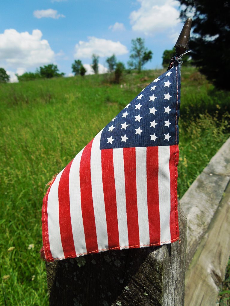
Just after taking this picture of a small American flag on a gate, we saw the first of two deer crossing the battlefield.


Walking along Otto Lane. In the distance, you can see some monuments in the field, testament to what happened here 151 years ago.


These two artillery pieces mounted on a ridge mark the furthest point of advance of the Union forces during the battle.


The beauty of the rolling hills belie the blood that was shed on this very soil. I imagine the same dichotomy must be felt when walking through the battlefields of the First World War.